
01
Satellite Navigation
Satellite Navigation Systems: Core Infrastructure for the Fourth Industrial Revolution
Satellite navigation systems provide positioning, navigation, and timing (PNT) data and are widely used for car and ship navigation, emergency rescue, and disaster prediction. Korea currently relies on the U.S. GPS system, which has an inherent positioning error of about 10 meters, making it unsuitable for high-precision applications, such as aviation and autonomous driving. Moreover, there is a risk of service interruption due to signal jamming or geopolitical tensions. To address this, KARI is leading the development of Korea’s own satellite navigation system—KPS—to deliver high-precision, high-reliability data services, which are expected to become key infrastructure in the Fourth Industrial Revolution. As a core infrastructure for the Fourth Industrial Revolution, KPS aims to match the centimeter-level accuracy already provided by systems in the United States, Russia, Europe, China, Japan, and India by advancing R&D efforts to establish a sovereign system.
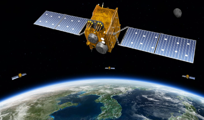
02
Korea Positioning System (KPS)
Providing High-Precision Positioning and Timing Information via Korea’s Own Satellite Navigation System
The system commonly known as GPS is a satellite-based navigation infrastructure that provides Positioning, Navigation, and Timing (PNT) information, and has become indispensable in today’s world. More recently, such systems have emerged as key infrastructure for technologies of the Fourth Industrial Revolution, including drones and autonomous vehicles. For a self-driving car to navigate roads safely without a human driver, all objects on the road must be mapped to a unified coordinate system with centimeter-level accuracy and reliability. This is referred to as absolute positioning information, and satellite navigation systems are currently the only PNT solution capable of providing it natively.
Korea is also planning to build a Korea Positioning System (KPS) under the 3rd Basic Plan for the Promotion of Space Development, with a target date of 2035. The KPS will be a high-precision, highly reliable satellite navigation system that can provide centimeter-level positioning information to the Korean Peninsula and surrounding areas, such as Japan and India, rather than to the rest of the world, such as the United States, Russia, Europe, and China. In peacetime, the system will be compatible with U.S. commercial GPS to provide higher quality services than currently available, and in times of emergency when GPS use may be limited, the system will be able to provide PNT information using only our satellite navigation system to secure a stable PNT information system.
- Objective : To provide six categories of PNT services tailored to diverse user needs
- Structure : Comprises a satellite system (KPS navigation satellites), a ground segment (including the Integrated Operations Center, Satellite Control Center, Antenna Stations, Monitoring Stations, and Mission Control Centers), and a user segment (KPS receivers)