Multi-purpose Practical Satellite (Arirang) No.5

  • Specification : Diameter 2.6 m, height 3.9 m, and weight 1,315 kg
  • Operating orbit : Low orbit
  • Mission : All-weather earth observation
  • Payload : All-weather imaging radar (SAR, resolution 1m)
  • Launch date : August 22, 2013
 
01

Korea’s first satellite to load imaging radar (SAR)

Arirang 5 is Korea's first earth observation satellite equipped with a Synthetic Aperture Radar (SAR) for all-weather ground and ocean observations above the Korean Peninsula.

The SAR mounted in Arirang 5 emits a microwave to an object on the ground and synthesizes the reflected signal to produce the image. It enables ground observation even during nighttime and poor weather. As part of Arirang 5's development, KARI developed a significant portion of its technology, excluding its main core technology, with domestic technology. The imaging radar payload’s core technology was developed through technical cooperation with overseas partners since it was not available in Korea. Through the development of Arirang 5, KARI was able to secure the technology related to imaging radar and imaging radar correction and processing technology.
Arirang 5 added four operational modes—improved high-resolution mode with resolution of 1m (observation width of 3 ㎞×3 ㎞), ultra-high-resolution mode of 0.85 m (2.7㎞×2.7㎞), enhanced standard-resolution mode of 2.5m (30 ㎞), and enhanced wide-area observation mode of 20 m (100 km)—through post-launch performance improvement to provide improved high-resolution, high-quality images.

Korea’s first satellite to load imaging radar (SAR): Subject, Imaging Radar Payload, Remarks
Subject Imaging Radar Payload Remarks
Mass 520kg Excluding the mass of the payload module structure
Maximum power consumption 1700W -
Incident angle 20 - 55˚ -
Standard-resolution mode 3 m (resolution) / 30 km (observation width) Based on incident angle of 45˚
High-resolution mode 1 m (resolution) / 5 km (observation width) Based on incident angle of 45˚
Wide-area observation mode 20 m (resolution) / 100 km (observation width) Based on incident angle of 45˚
Polarized observation Selected observation among HH, HV, VH, and VV -
Image acquisition time Average of two minutes per orbit Time for longitudinal observation of the Korean Peninsula
Image storage capacity 256Gbit -
Image transmission capacity 310Mbps Real-time transmission of observed images of the Korean Peninsula
02

Imaging Radar (SAR) Satellites Worldwide

Move from side to side
Imaging Radar (SAR) Satellites Worldwide:
Country Satellite Resolution Altitude Weight Year Launched
Germany TerraSAR-X 1m, 3m, 16m 514km 1,230kg 2007
TanDEM-X 1m∼16m 514km 1,330kg 2010
Italy Cosmo-SkyMed-3 ≤1m, 3m∼100m 619km 1,700kg 2008
Cosmo-SkyMed-4 ≤1m, 3m∼100m 619km 1,700kg 2010
Israel TecSAR-1 ≤1m, 3m, 8m 550km 300kg 2008
Russia Kondor-E1 1m ~ 3m 550km 800kg 2010
 
03

Securing radar images in any weather, be it day/night

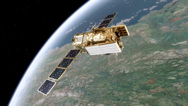
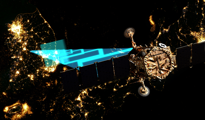
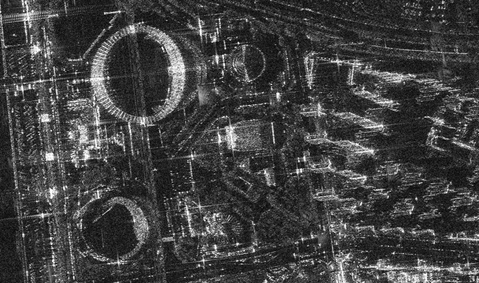
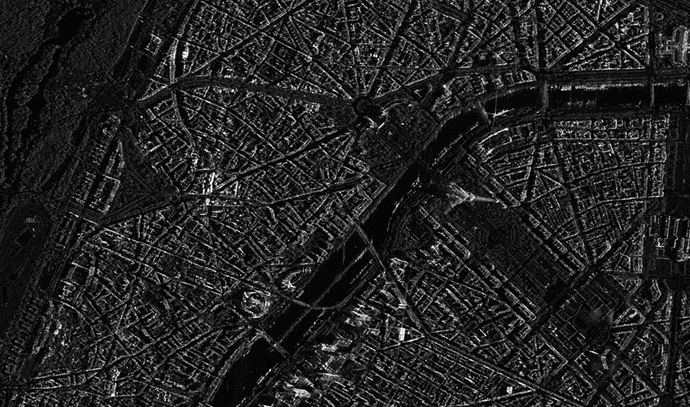
The development of Arirang 5 enabled securing not only existing optical images but also all-weather, day and night radar images as demanded in Korea. Arirang 5 is capable of all-weather observation and is used in national disasters and emergency management by complementing the optical and IR images of Arirang 2, Arirang 3, and Arirang 3A. The images of Arirang 5 can be used for geographic information systems (GIS), ocean observation, ground observation, disaster monitoring, and environmental monitoring. They are currently used for land and urban planning, water resources, agriculture, ocean, forestry, environment, map production, and geological resource utilization.
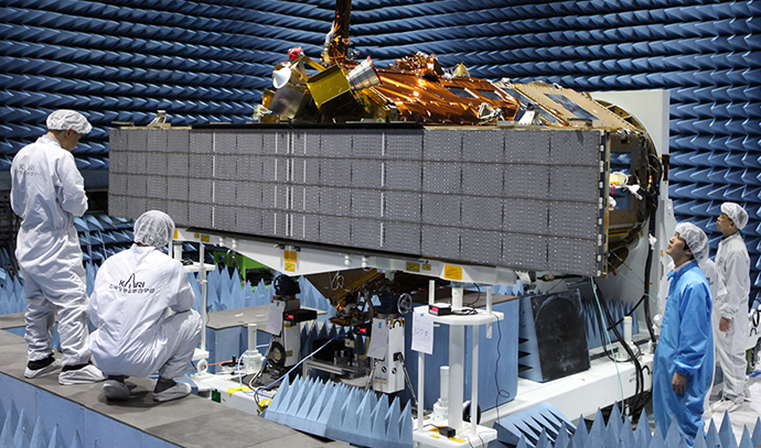
The development of Arirang 5 opened an opportunity to secure the basis for the development of the Arirang 6 imaging radar with resolution of 50 cm with Korean technologies and imaging radar correction and processing technologies. Arirang 5 has successfully completed its mission for five years, operating for an extended period of 2 years as of 2019.

맨위로