
The European EO Services Industry: Development
of the market and the impacts of GMES
Geoff Sawyer , EARSC Secretary General
13th February 2012, Vienna

What is EARSC?
o
EARSC is a non-profit-making organisation created in 1989 as
the voice of the European geo-information EO service industry
o
Mission & objectives:
o
to foster the development of the European Geo-Information
Service Industry
o
to stimulate a sustainable market for Geo-information
services using EO data, openly accessible to all members
o
Today EARSC has 70 members in more than 22 countries, and
is a recognized association worldwide
o
Represents European geo-information providers creating a
sustainable network between industry, decision makers and
users
Presentation to UNOOSA, Industry Symposium 13th February 2012

European EO Services Industry
• Offers a full range of services based on extensive experience
serving government, industry and the citizen
• Includes data providers, downstream service providers, software
and consultancy companies with a mastery of space-
borne/airborne/in-situ systems and sensors technologies.
• Innovative / dynamic; many new companies, changing ownership
• Between 100 and 200 companies largely SME’s with strong
partnership experience across European borders.
• Estimated as €800m to €1b annual revenues.
• Highly skilled workforce; interchange with other sectors
• Last survey in 2006 identified 152 organisations.
• Full industry survey will be made by EARSC during 2012.
Presentation to UNOOSA, Industry Symposium 13th February 2012

What does EARSC do?
To achieve our mission, we focus on:
Improving customer awareness and acceptance of Earth
observation and remote sensing based solutions
Improving market access for our members
Promoting our members capabilities
Engaging with key organisations (ESA, the EC and
others) to make the EO VA sector’s views known and
acted upon.
EARSC works with many partners to achieve these goals.
Presentation to UNOOSA, Industry Symposium 13th February 2012

How can EARSC help?
For Companies:
o
Networking: meet and partner with other member companies
o
Communications - website, newsletter, directorate, numerous events
on both European and International stages.
o
Information on the EO services industry and on potential markets.
o
Exchange of best practice and common standards.
For Companies and Clients:
o
EOpages is a web-based marketplace for users to find the services
they need and suppliers to provide them.
o
OGEO Portal is a web-based tool to enable Oil & Gas and EO
service industries to work together.
Presentation to UNOOSA, Industry Symposium 13th February 2012
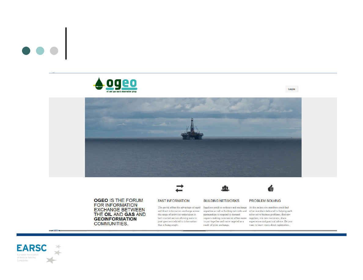
OGEO Portal
Presentation to UNOOSA, Industry Symposium 13th February 2012
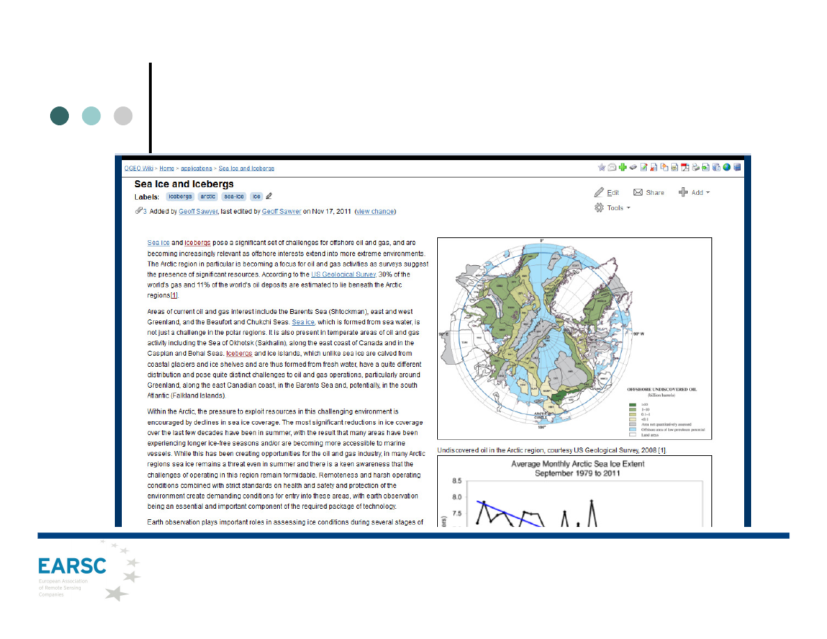
OGEO Portal - Applications
Presentation to UNOOSA, Industry Symposium 13th February 2012

OGEO Portal – Success Stories
Presentation to UNOOSA, Industry Symposium 13th February 2012

EOpages – home page
Presentation to UNOOSA, Industry Symposium 13th February 2012
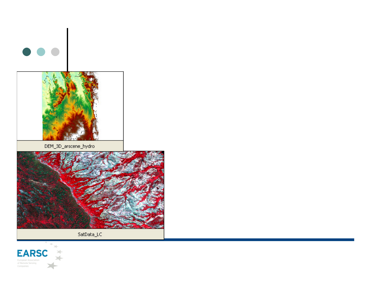
Infrastructure Development Planning
•
Users: Int. Fund Agricultural Development,
Madagascar
•
Need: Situation awareness information of large
areas in Madagascar to contribute to an improved
development planning for agricultural production
•
Challenge: Identify service areas with potential for
further agricultural activities within the region
•
Initiative: Production of Land Cover Maps for
agricultural activities within the river valleys and
Digital Elevation Models to support the actual
development planning within the region using high
spatial and thematic accuracy.
•
Results:The information provided through this
service and its product haslead to a more efficient
development planning
•
Service provider: GAF-AG (www.gaf.de)
Fig.1 3D Overfly DEM
within the area of
Service Trial 2 using
ESRI ArcScene with
Basic Drainage System
overlay
Fig.2Samples of
Satellite imagery in
CIR and Land Cover
overlay
Earth Observation Support to Urban Development
Presentation to UNOOSA, Industry Symposium 13th February 2012
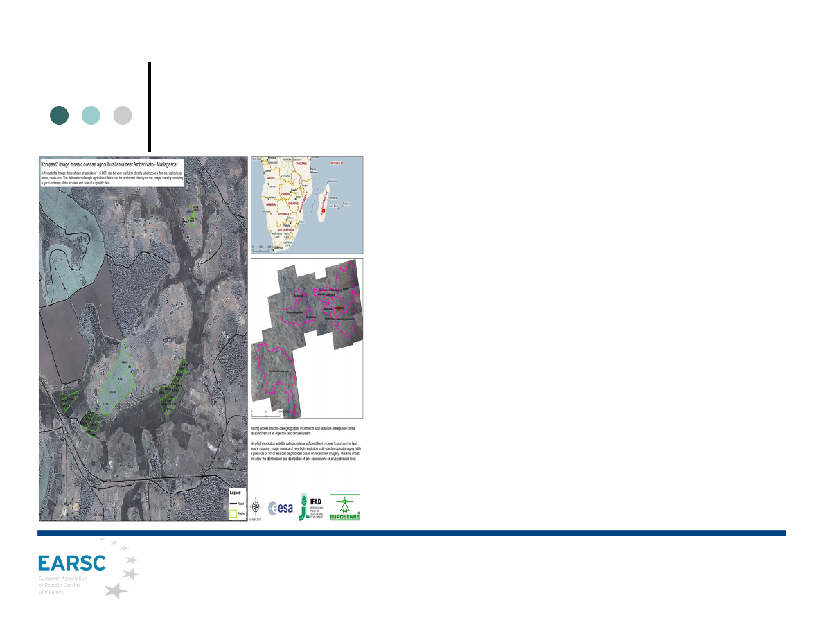
Image support for land tenure mapping
•
Users: Int. Fund Agricultural Development,
Madagascar
•
Need: Support the current land reform programme
(facilitating the issuance of land certificates)
•
Challenge: Provision of earth observation to facilitate
the delineation of titled land parcels
•
Initiative: Very High Resolution optical satellite data
can provide a detailed and homogeneous view of
agricultural areas (identify and delineate of land
concessions on a very detailed level)
•
Results:Land titling creates a security of tenure and
increases investment in land, agricultural productivity,
and land values hence an overall improvement of
income situation and standard of living
•
Service provider: Eurosense (www.eurosense.com)
•
More info: www.ifad.org,
www.eomd.esa.int/index.asp
Earth Observation Support to Urban Development
Presentation to UNOOSA, Industry Symposium 13th February 2012
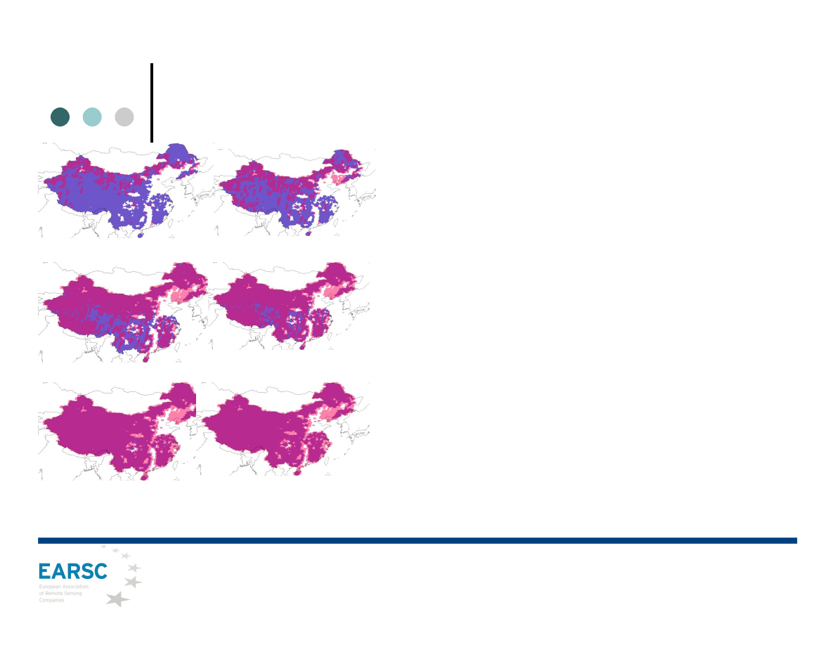
Wide-area Urban Development
•
Users: Ministry of Land and Resources in China
•
Need: Complete and uniform coverage for
mapping, monitoring and change detection
•
Challenge: Full area coverage within 6 months
window; optimal collection of low or cloud-free data
to be delivered on time
•
Initiative: RapidEye satellite constellation is an
operational system with the combination of
capabilities which allow for repetitive coverage of
large areas acquiring consistent data in high
resolution with an option for daily revisit to an area.
Some uses were focus on monitor their agricultural
lands and protecting it from illegal urban sprawl
•
Results: Quick coverage and delivery of the
country (5.8 Milion km2, 60%) during the 2009-2010
growing season
•
More Info: RapidEye (www.rapideye.de)
Fig. color coded map showing the coverage RapidEye provided
during the 2009-2010 collection by month.
Earth Observation Support to Urban Development
Presentation to UNOOSA, Industry Symposium 13th February 2012
Assisting urban planning activities
•
Users: World Bank
•
Need: Assist urban planning activities
•
Challenge: Provision of up-to-date EO based land
monitoring products focused on various aspects of
urbanized areas
•
Initiative: Identification of infrastructure,
settlements including classification into urban
density classes, hydrology or environmental threats
at different levels of detail.
•
Results:Investment done will return in practical
consequences of the fact that planning activities in
Greater Baku area in following years could be based
on accurate and up-to-date information
•
Service provider: Gisat (www.gisat.cz/content/en)
•
More info: www.respond-int.org
Fig. Baku regional development graphic
Earth Observation Support to Urban Development
Presentation to UNOOSA, Industry Symposium 13th February 2012
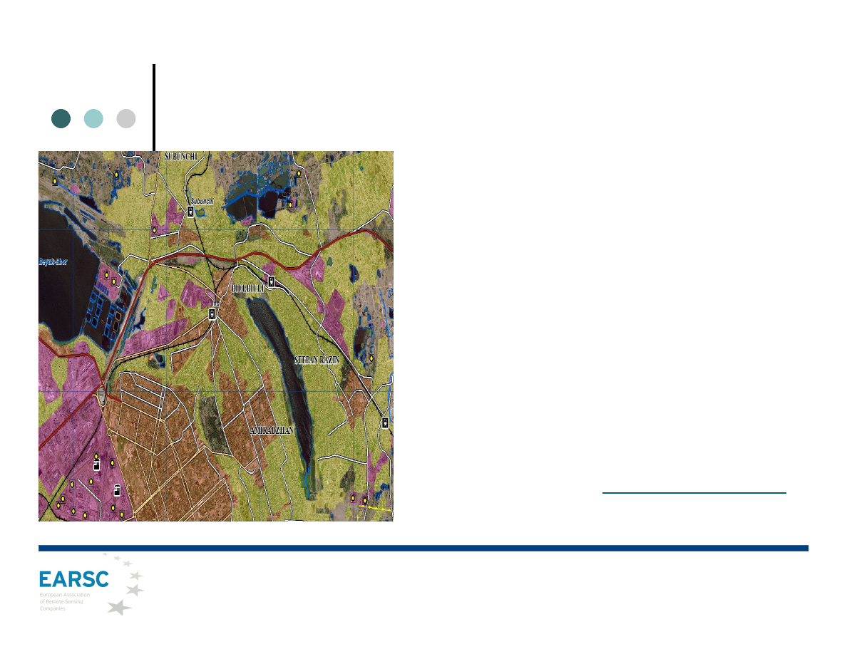
Assessing Natural Hazards & Climate Change Risks
•
Need: Evaluate spatial assessment of natural hazards and climate change risks and help to
address the critical knowledge and capacity gaps of local governments in dealing with rapid peri-
urban expansion into areas that may face vulnerability to natural hazards, including those risks
associated with climate variability
•
Challenge: Develop, demonstrate and provide a method for identification and diagnostics for Peri-
Urban Expansion Risks
•
Initiative: Provide series of information on: Multi-temporal land cover mapping and population
distribution, natural single and multi-hazard potential, social exposure and vulnerability, built-up
areas and vacant land exposed to hazards
•
Results: Critical information for the formulation of action plans to ramp up natural hazard and
climate change risk management practices
•
Service provider: Geoville (www.geoville.com/apps/urbanmapping/climate-change-risk.php)
Fig. Hydrologic modelling output of flood risk areas in part of
semi-urban areas outside of Dakar, Senegal.
Users: World Bank’s Spatial and Local
Development Team (FEU, SDN), WB
Senegal Office
Integration of Satellite EO Technology in Disaster Management
Presentation to UNOOSA, Industry Symposium 13th February 2012
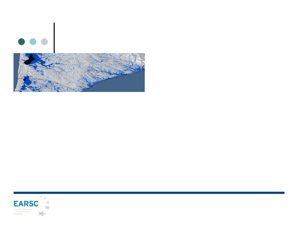
Mapping long term trends in deforestation in tropical regions
•
Users: Brazilian National Institute Space Research
(INPE)
•
Need: Satellite imagery to estimate Amazon Basin
deforestation assessment, rapid revisit times and wide
area coverage.
•
Challenge: Achieving a full coverage in short imaging
windows to achieve homogeneity of data for analysis and
reducing the impact of cloud cover common to tropical
rainforest regions.
•
Initiative: DMC wide swath images can cover huge areas
and they reduce the time of the analysis significantly. It
provided reliable annual large area coverage, and multi-
temporal coverage of high risk areas.
•
Results: Frequent forest monitoring with timely action
leads to significant decrease of deforestation and prevents
forest loss.
•
Service provider: DMCii (www.dmcii.com)
Right. Fire and burn scar in Matto
Grosso region, (Brazil).
Left. 11/08/2010 , UK-DMC2, 22m
resolution
DMCii develops its own value-added products: clear cut detection,
forest/non-forest classification maps, land cover classification.
Integration of Satellite EO Technology in Climate Change
Presentation to UNOOSA, Industry Symposium 13th February 2012
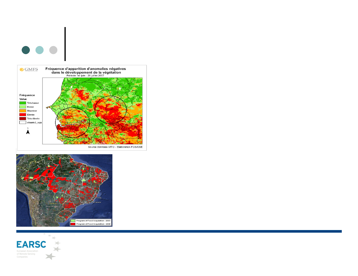
Supporting agricultural and food security decisions
•
Users: Centre Suivi Ecologique, Senegal and CONAB,
Brazil
•
Need: Accurate and timely information on the growing
season utmost importance for decision making
•
Challenge: Implementation of appropriate interventions
aimed to manage the risk of food insecurity in time
•
Initiative: Use low cost data, daily meteo achieves and
field observation to obtain Vegetation Productivity
Indicators to develop further tools for faster and more
adequate decisions
•
Results: Early warning. EO data ensures rapid,
accurate and timely information over large areas of the
countries
•
Service provider: VITO (www.vito.be),
•
More info: www.gmfs.info, www.devcocast.eu
Fig 1. Frequency
analysis of negative
anomalies at the
start of the growing
season. Red
indicates high
anomalies
Fig 2. Comparison
of family agriculture
in Brazil, Food
Acquisition
Programme
Earth Observation Support to Agriculture and Rural Development
Presentation to UNOOSA, Industry Symposium 13th February 2012
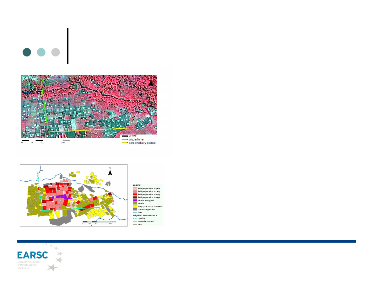
Implementing & managing agriculture projects
•
Users: Ministry Agriculture Malawi
•
Need: Develop a sustainable irrigation plan and
environmental impact assessments
•
Challenge: Preparation for an irrigation plan to avoid
erosion and reduced transport capacity of the water flow
•
Initiative: Very high resolution images on irrigation
sites used to make a detailed map outlining the irrigation
scheme (timing of cultivation steps &greenness of the
crops) providing a good inventory of the infrastructure.
Information was derived by visual interpretation, image
classification, analysis of NDVI-temporal profile
•
Results: Land cover maps facilitate the selection of
new irrigation sites, or the impact assessment of existing
schemes helping to target field visits or to make the
management of very large schemes more efficient
•
Service provider: VITO (www.vito.be)
Fig 1. Map showing parcel management of a small scale irrigation
scheme during dry season of 2010.
Fig 2. Overview of a small scale irrigation scheme with a false colour
near infrared image of 1m resolution.
Earth Observation Support to Agriculture and Rural Development
Presentation to UNOOSA, Industry Symposium 13th February 2012
EARSC and GMES
GMES is a key European public programme to provide space-
derived information on environment and security to European
policy makers and citizens.
GMES provides a strong opportunity as a market driver for EO
Services.
Industry has invested quite heavily with the goal to exploit
opportunities using GMES products & services in other markets eg.
commercial, export and non-EU government.
Hence, EARSC has a strong interest in the way GMES will be
implemented:
3 Position papers available on EARSC web-site.
Presentation to UNOOSA, Industry Symposium 13th February 2012
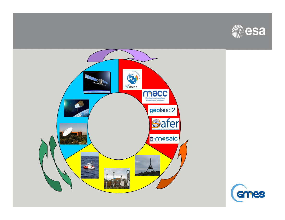
We care for a safer world
GMES Components
GMES
In-situ Component Land, air and water monitoring sensors
Services
Component
Information
services for
land, marine,
atmosphere,
emergency,
security and
climate
change
Space
Component
Sentinels,
Contributing
Missions
and related
Ground
Segment
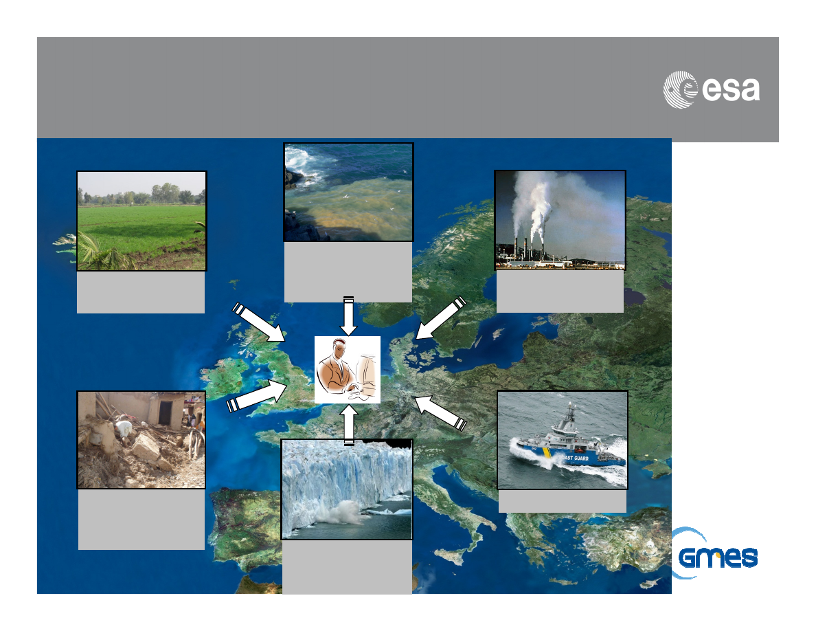
We care for a safer world
GMES Services domains
Land
monitoring
Marine
environment
al monitoring
Atmospheric
monitoring
Emergency
management
response
Climate
Change
monitoring
Security
We care for a safer world
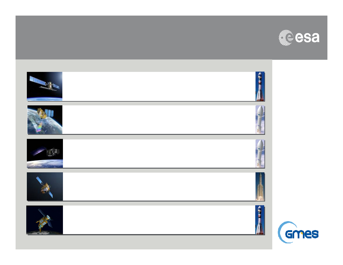
GMES dedicated missions: Sentinels
2013 / 2015
Sentinel 1 – SAR imaging
All weather, day/night applications, interferometry
2013 / 2015
Sentinel 2 – Multi-spectral imaging
Land applications: urban, forest, agriculture,..
Continuity of Landsat, SPOT
2013 / 2014
Sentinel 3 – Ocean and global land monitoring
Wide-swath ocean color, vegetation, sea/land
surface temperature, altimetry
2019
Sentinel 4 – Geostationary atmospheric
Atmospheric composition monitoring, trans-
boundary pollution
2019
Sentinel 5 – Low-orbit atmospheric
Atmospheric composition monitoring
(S5 Precursor launch in 2015)
EARSC and GMES Data Policy
Development of the market is best supported by raw data being made
available at low or zero cost:
Raw data from Sentinels should be free and open.
Data from commercial satellite operators should be procured under
appropriate license conditions.
Core services to be freely and unconditionally available to all
European users.
Downstream services should be procured commercially on a fair
and competitive basis.
A registration system for GMES users should be put in place to
ensure that basic quality conditions are met and licensing
conditions are respected as well as achieving fair competition
(reciprocity) on the international market.
Presentation to UNOOSA, Industry Symposium 13th February 2012
Summary
o
EARSC provides stakeholders with an effective interface to the EU
EO services industry
o
Neutral support to find suppliers and obtain contractual services
o
Eopages will provide a first entry point to the full range of
services being offered.
o
OGEO-Portal provides an example of a link to a specific client
community
o
GMES will be an opportunity for users and industry to develop new
markets and services.
www.earsc.eu / www.eomag.eu / www.eopages.eu / www.ogeo-portal.eu
Presentation to UNOOSA, Industry Symposium 13th February 2012
